HIVDI algorithm (SWOT Mission)
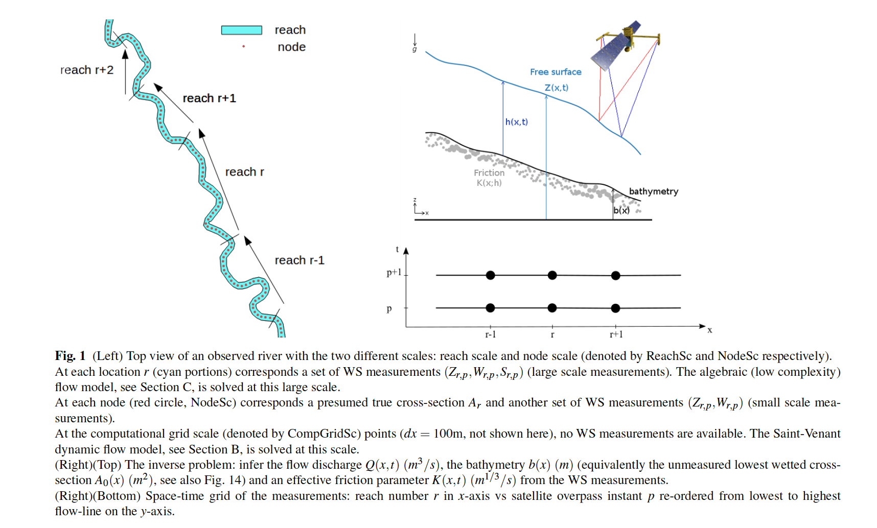
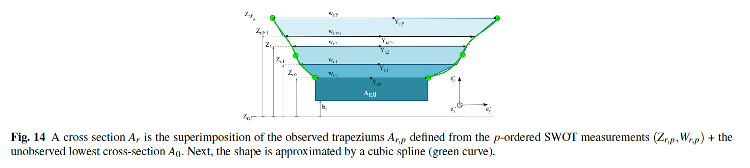
Description of the solved inverse problem. Images extracted from [Larnier-Monnier, Compt. GeoSci. 2023].
What is HiVDI ?
HiVDI = Hybrid Hierarchical Variational Discharge Inference
The HiVDI algorithm aims at estimating rivers discharge and rivers bathymetry from measurements of the SWOT instrument (NASA-CNES et al. mission).
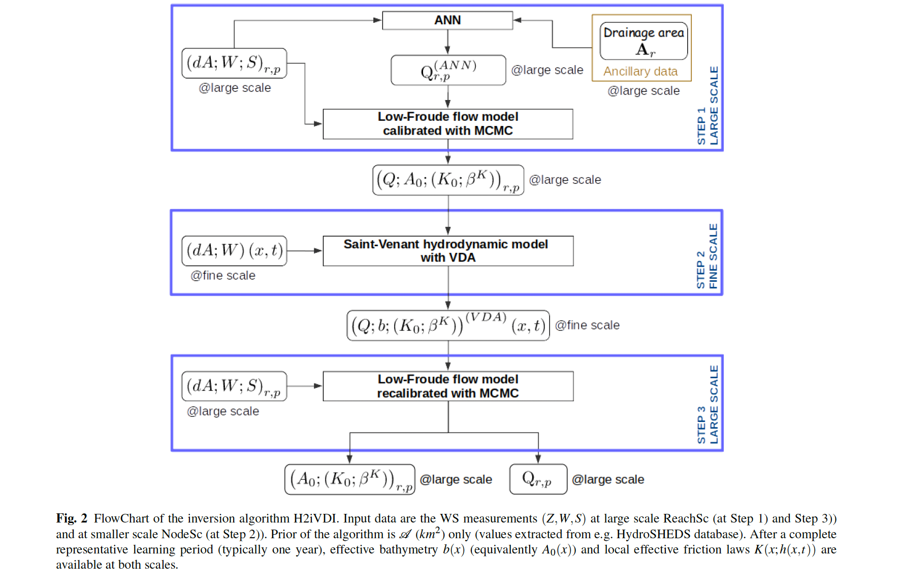
In a nutshell, the algorithm relies on
DassFlow1D code
, Deep Learning and a Bayesian analysis, see figure below (details available in [Larnier-Monnier 2023]).
SWOT measurements
SWOT instrument is an altimeter providing Water Surface Elevation (WSE) and river width measurements at ~250 m scale (with an accuracy +/-10cm for WSE). Each overpass provides two swaths of 60 km width each at ~10-20 days frequency depending on the location on Earth.
Here a report of historical thoughts of founders.
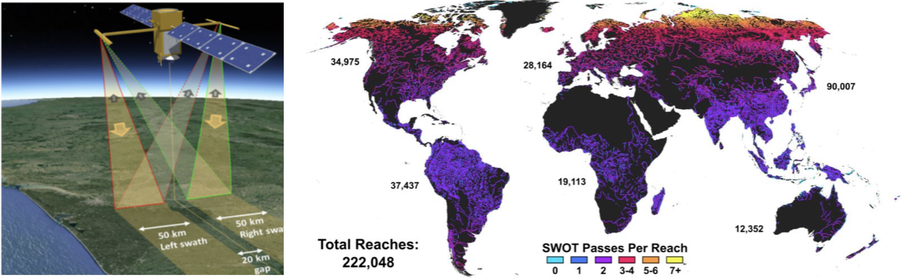
Figure. (L) SWOT mission (launched nov. 2022, NASA-CNES et al.). (R) Number of reaches (~10 km long) observed by SWOT instrument: the SWORD database from [Alteneau-Pavelsky et al. (2021)]. (SWOT Science Team).
Initial - “historical” thoughts
Below a few short notes on the SWOT blog too: